
Descanso, CA – A Place To Rest
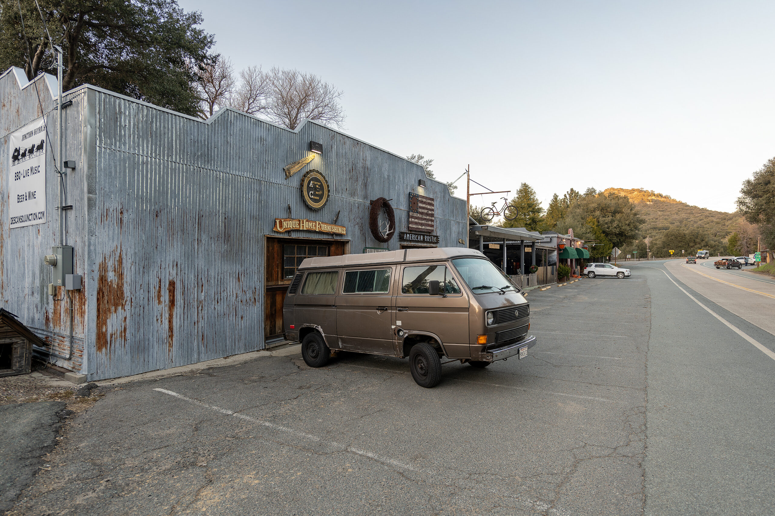
A Spanish name, referring to “rest from labor.” Driving along one encounters some charming Descanso businesses – roadside stops on the roads leading to Cuyamaca State Park and Cleveland National Forrest.

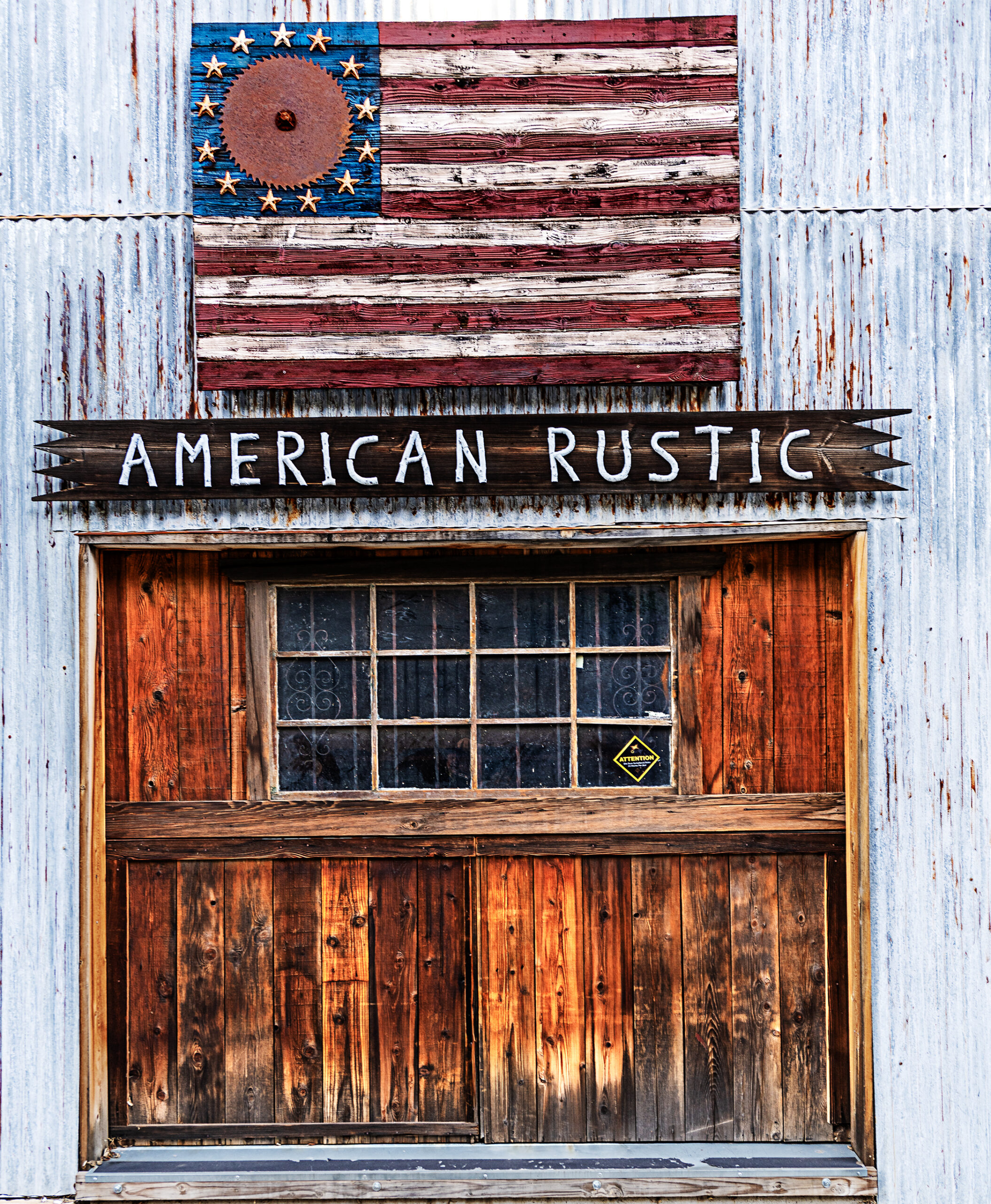
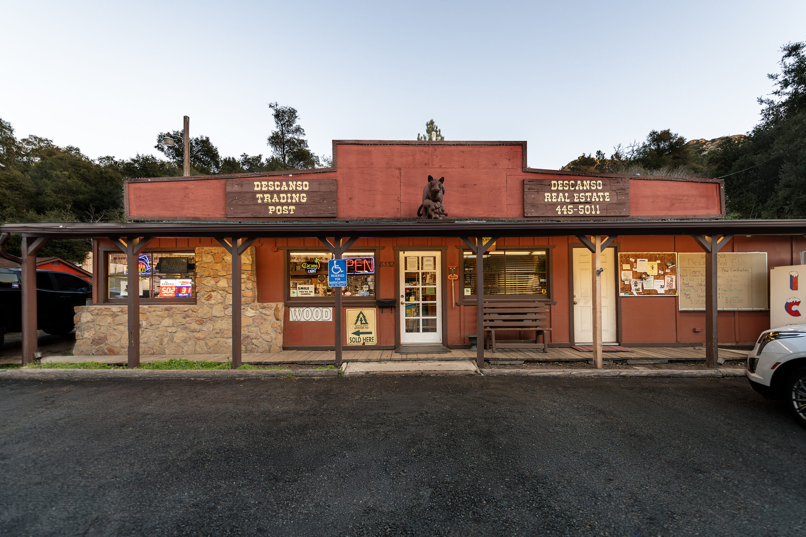

A Spanish name, referring to “rest from labor.” Driving along one encounters some charming Descanso businesses – roadside stops on the roads leading to Cuyamaca State Park and Cleveland National Forrest.

Beginnings of this landmark began in 1852 when Louis Rubidoux purchased the land and surrounding area.
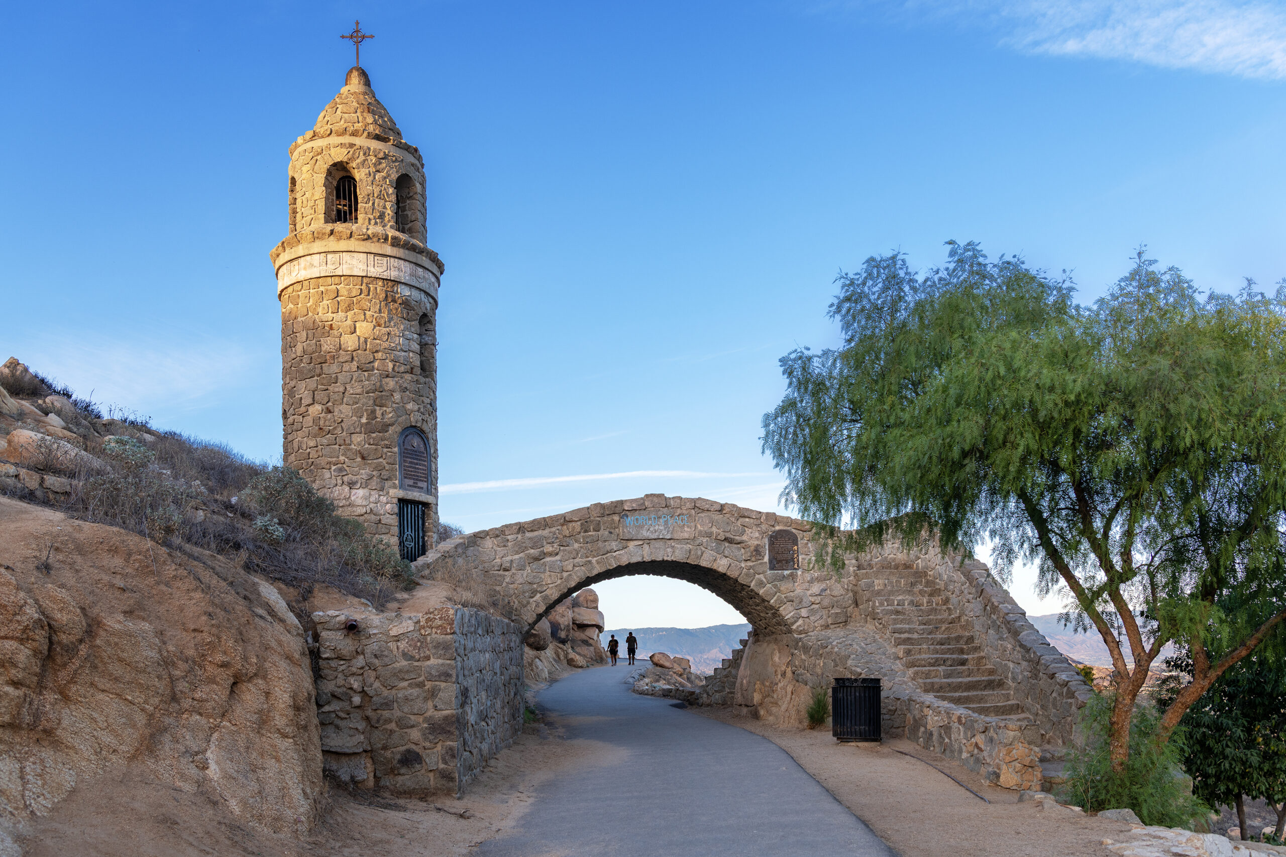
Late December 1905/Early January 1906 The Huntington Park Association was founded, spear headed by Frank A. Miller – Developer and Owner of Riverside’s Mission Inn – and by railway magnate Henry E. Huntington.

Originally called Huntington Park, the name was changed to the Frank A. Miller Mount Rubidoux Memorial Park after the heirs of Frank Miller donated the property to the city in 1955.
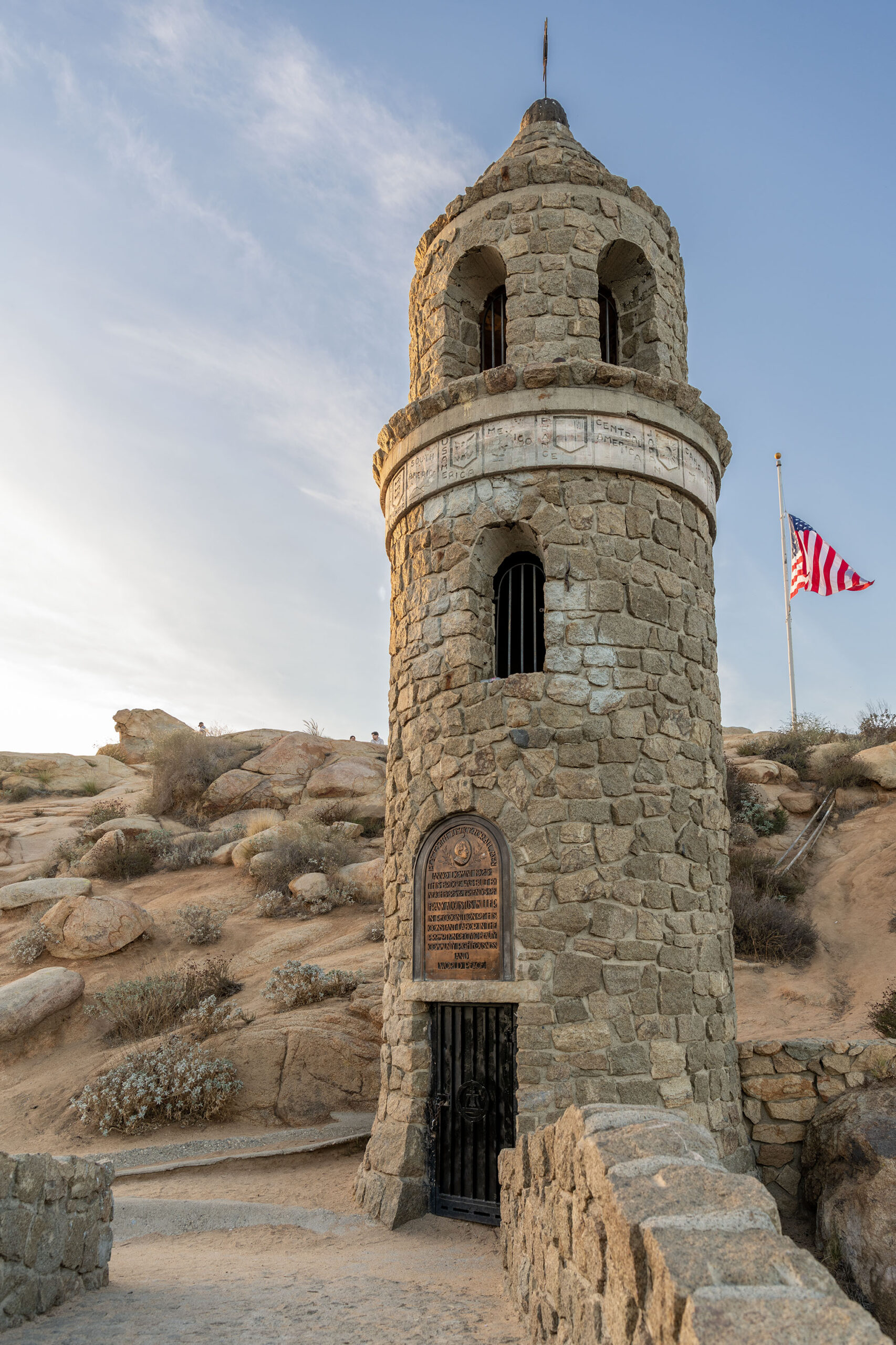
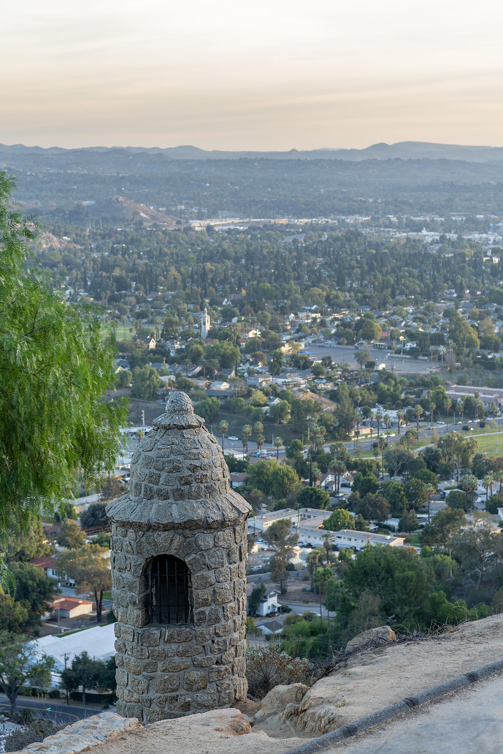
On December 13, 1925, the Testimonial Peace Tower was dedicated to Miller.

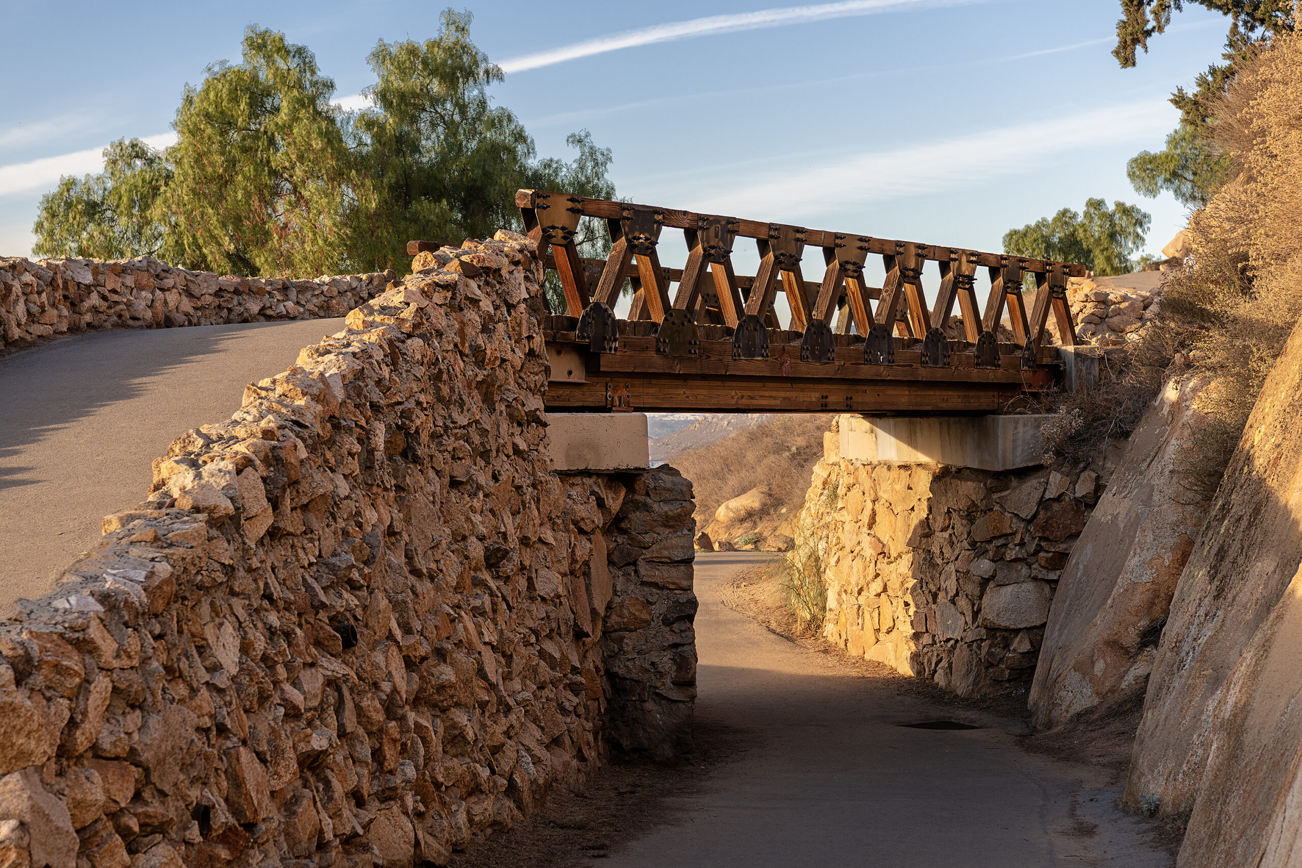
The bridge is a replica of a noted bridge in Alcántara, Spain.

Initial improvements, including the road – Huntington Drive, were completed in February 1907
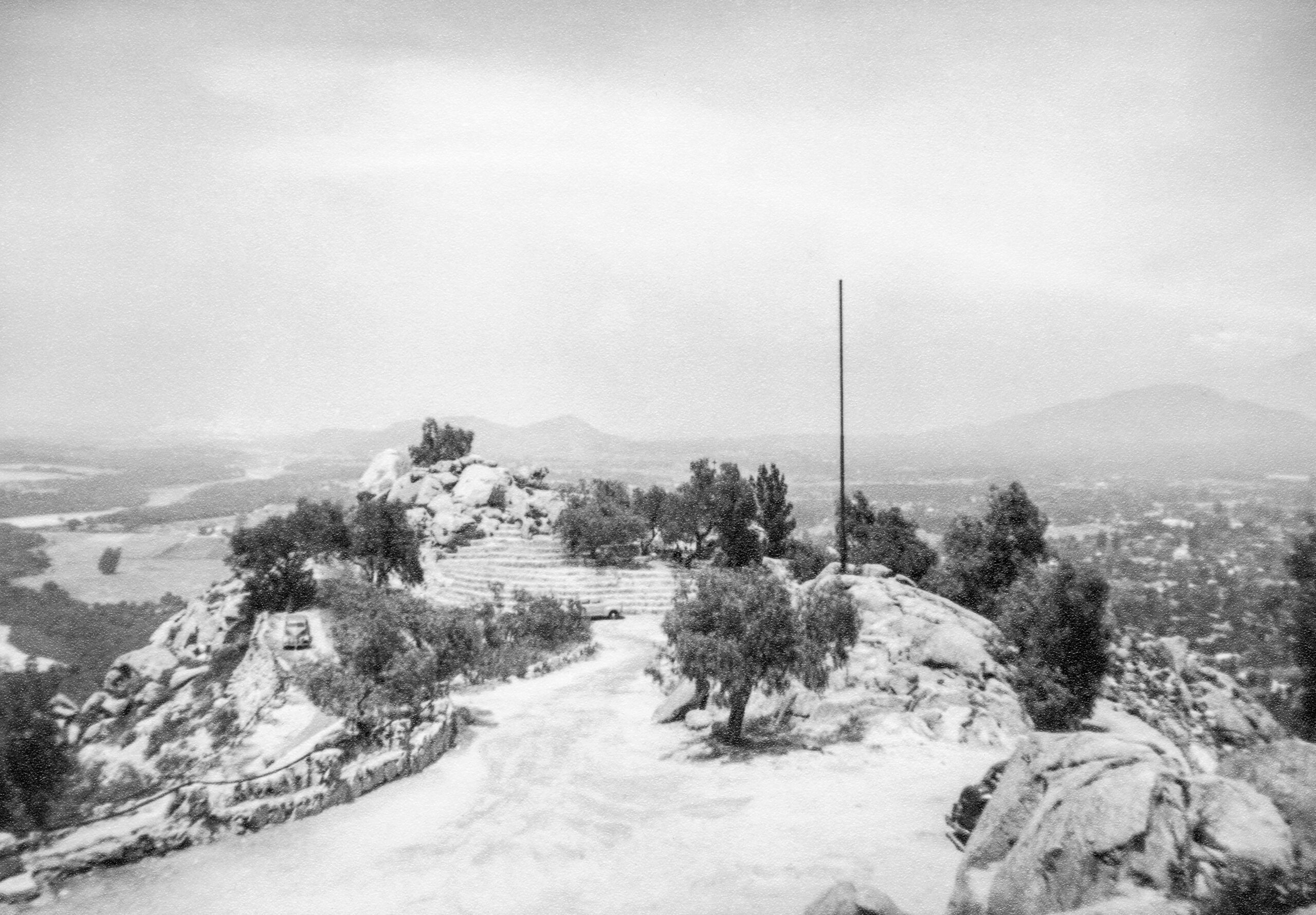
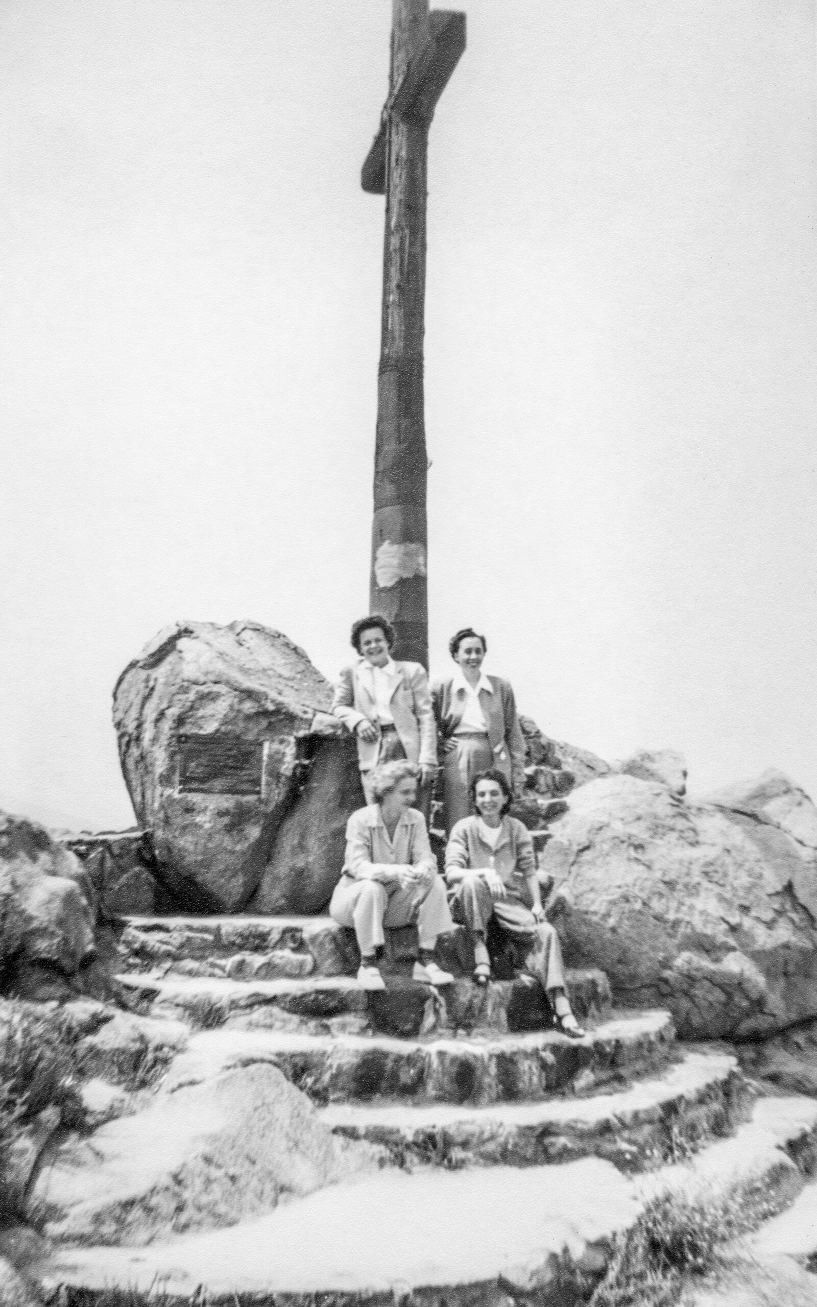
A set of black and white images to follow from the late 1940’s. A group of women stopped here on a road trip. Notice the automobile access on Huntington Drive. Strictly foot traffic nowadays.
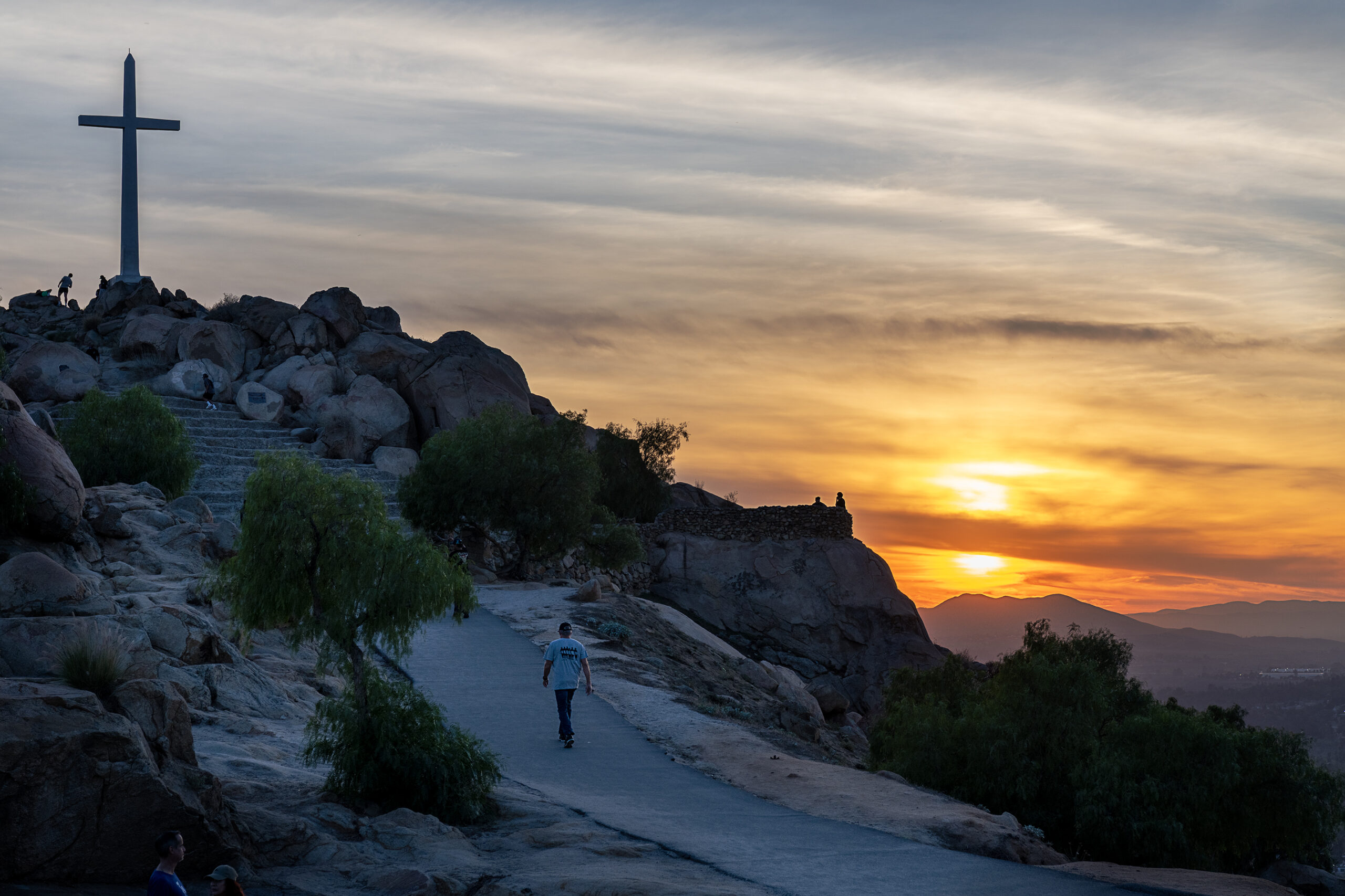
The original wooden cross at the summit honors Father Junipero Serra, and was dedicated on April 26, 1907. Serra supposedly often travelled through the valley and rested at Rubidoux Rancho

The wooden cross and memorial plaque at the summit honoring Father Junipero Serra.
The annual non denominational Easter Service is internationally known, and draws a huge turn out every year. The city also launches its premier fireworks show from the top of the mountain every Fourth of July.

As seen at many landmarks that feature a giant cross, there was controversy in Riverside. In response peak was sold to a non profit, non governmental group, Totally Mt. Rubidoux. It operates as the Rivers & Lands Conservancy is the the sole owner and manager of Mt. Rubidoux Peak.
By appearances and all accounts the Rivers and Lands Conservancy does a good job preserving and maintaining the Mount Rubidoux roads and infrastructure. The park is very popular among residents and tourists alike


The West Theatre was originally to be named El Sol Theatre and four walls were built by owner C.E. Means. It was taken over by J.C. West who completed the theatre named it after himself. It opened in April 1959 as a single screen theatre and was later converted to a twin. The balcony was converted to the second screen. Ref – Cinematreasures.org


Multiple sources including former employees confirm that the Lux Theatre was open through 1980. “Up In Smoke”, “Good Guys Wear Black”, “Urban Cowboy” all played there. Ref – David Zoring, May 8, 2022 Cinematreasures.org


The sleek tile facade and terrific neon stand on duty for Pat’s business that is sadly now shuttered.


New Miners Building

Old Miners Building?

The Charlie’s Radiator Service building was built by the then 29 year old Charles Diaz assisted by his maternal grandfather, Joseph Capelli, an Italian immigrant stone mason. Together they used pumice block to construct the garage. Charlie opened his Automotive Service in 1943 with two gas pumps, a garage and body repair. In the early days he sold Mobil gas. By the mid 1950s when Route 66 was widened the gas pumps were long gone and he had quit selling gas and began to specialize in radiator repair. He continued working until 1995 when he died of a heart attack. Ref – Route 66 Times


Roaring 20s SpeakEasyAurant sign remains. The building does not.


Another Route 66 landmark crumbling to pieces.

The office window is broken out. Once the rain comes pounding through – not to mention animals – that spells the end. A terrific roof time neon once adorned the office.

The neon was later upgraded to include a swirling arrow on top to direct road travelers to stop here.


The site today appears to be used for storage or perhaps migrant housing. There are numerous broken and some late model cars parked there.


Tourists pose for a photo next a statue of Jackson Browne.
The Route 66 town of Winslow fully embraces the Rock lore and legend created by The Eagles in their song Take It Easy.


Well, I’m a standing on a corner in Winslow, Arizona
And such a fine sight to see
It’s a girl, my Lord, in a flatbed Ford
Slowin’ down to take a look at me…


The 1914 Thomas Dye Building East with its Winslow House ghost sign. This building was originally a mercantile company. On May 26, 1939, this building became the first Spanish-speaking movie theater, the Chief Theater, in Northern Arizona. The projection room is still intact in the upper level.


The 1912 Elks Building. It stands across the street from the Standing On The Corner exhibit and park, and the statues of Jackson Browne and Glenn Frey. It’s on the National Register of Historic Sites.

66 Motor Palace – a former pool hall, motorcycle shop, and notorious “after hours club,” Today the Motor Palace is a personal residence and preservation project.

Park Place Art Gallery. The building could use some window restoration…

Heading out of town at dusk.

For next time. I missed it this time – once the sun went down I headed out of town. Definitely should have spent the night – at La Posada!

Ghost Sign in a Ghost Town. Entrance to the Two Guns Zoo enclosures built in the 1920’s

It was the brain child of Henry “Two Gun” Miller. He leased land from town developers Earle and Louise Cundiff who had already established a gas station and eatery at Canyon Lodge which became a busy stop for those traveling to and fro the west coast.

The Hopi, Navajo, and Apache are among tribes that live in the Two Guns area. Two Guns sits on the rim above Diablo Canyon. The Navajos and Apaches often fought each other and used the Diablo Canyon to seek refuge and as a point to launch attacks. One legend tells of a battle that ended in an area of Two Guns which is known as the Apache Death Cave.
In one such battle Navajos discovered raiding Apaches were hiding in the cave with their horses. The end result was deadly for 42 Apaches. And so it became the Apache Death Cave.

Zoo builder Henry “Two Gun” Miller liked to be known as Harry “Indian” Miller – he was not Indian. He also ran a tourist shop from which he sold skeletal remains taken from the Apache Death Cave and bought by tourists.

Harry “Indian” Miller, seems to have built up some bizarre “karma” not only from impersonating as an Indian, and looting the Apache Death Cave, but became embroiled in a dispute with town developer (and landlord) Earl Cundiff. Miller pulled a gun and shot Cundiff to death. Then later acquitted.
Following that Miller was mauled by two mountain lions and was bitten by a poisonous gila dragon and became ill. He left Two Guns, never to return. Miller ran the zoo and tourist attraction from 1925 – 1935.

Considering the seemingly inhumane Two Guns animal enclosures, no wonder Miller’s animals attacked him.


The 1915 National Register Landmark Diablo Canyon Bridge, Two Guns, Arizona. It was built when the road was known as either the Santa Fe Highway or the Old Trails Highway. Later Route 66 was aligned using the National Old Trails road. Later the bridge was bypassed and abandoned in the 1930’s.


One of the twins is knocked down or fallen. The site is severely vandalized and seemingly destined to become desert dust.


From Michael Wallis’s book The Mother Road “Twin Arrows has the look and feel of the old wayside businesses along the highway. “

“Inside the small eight-stool diner, fry cooks serve up good road grub–steak and eggs and hash browns–despite a joke menu that talks about buzzard eggs, fried pack-rat tail, sagebrush coffee, roasted jack-rabbit ears, meteor crater stew, braised rattlesnake hips, sautéed centipede legs, prickly pear pie, and lizard tongue pudding.”


The pre-Interstate view of the Twin Arrows Trading Post. The 1946 Jack D. Rittenhouse book “A Guide Book To Highway 66” reads “One establishment offering gas, lunchroom, and curios. At the rear of the building is a small zoo exhibiting western animals. In previous years US 66 ran behind this building.”
Operations were shuttered in 1995.

The ruins are owned by the Hopi Tribe. In 2009 they partnered with Route 66 volunteers to restore the arrows and the trading post building, but sadly the site has succumbed to the elements of nature and vandalism ever since.


From San Diego to El Centro to Gila Bend to I 17 up to Flagstaff


Route 66 Road Trip…to be continued.

It’s one of California’s oldest surviving Spanish-Mexican one-story town houses in California from the time of Mexico’s Independence. It had great social prominence reflecting Captain José María de Estudillo’s position as a commander of the San Diego Presidio.

José Antonio and María Victoria lead a life of community involvement – both socially and, politically. It was considered at the time to be one of the finest houses in Mexican California. Estudillo’s involvement and influence continued through the American period as well.

Estudillo served as revenue collector, treasurer, mayor, justice of the peace, judge of San Diego under Mexican rule, and later as treasurer and assessor of San Diego County under American rule. While José Antonio played an active role in the development of early San Diego, his wife fully participated in the life of the Mexican pueblo and the new American city.

By 1906 the house was nearly in ruins. It was John D Spreckles who stepped up as a Preservationist in 1910, assigning Architect Hazel Waterman to spearhead the restoration of the home. The Estudillo House became popularly linked with the legend of Romona’s Marriage Place. Under that moniker it became a popular tourist destination for many years. On one day in 1940, “Ramona’s Marriage Place” drew 1,632 visitors.
Today it is under care of the the Old Town San Diego State Historic Park as National Register Historic Site and museum.